
Autonomous Forest DronesSurvey, Analyze, Optimize with AI
Fully autonomous drone technology that navigates below forest canopy, delivering millimeter-accurate individual tree data 30-100x faster than manual methods.
Request DemoThree Core Systems
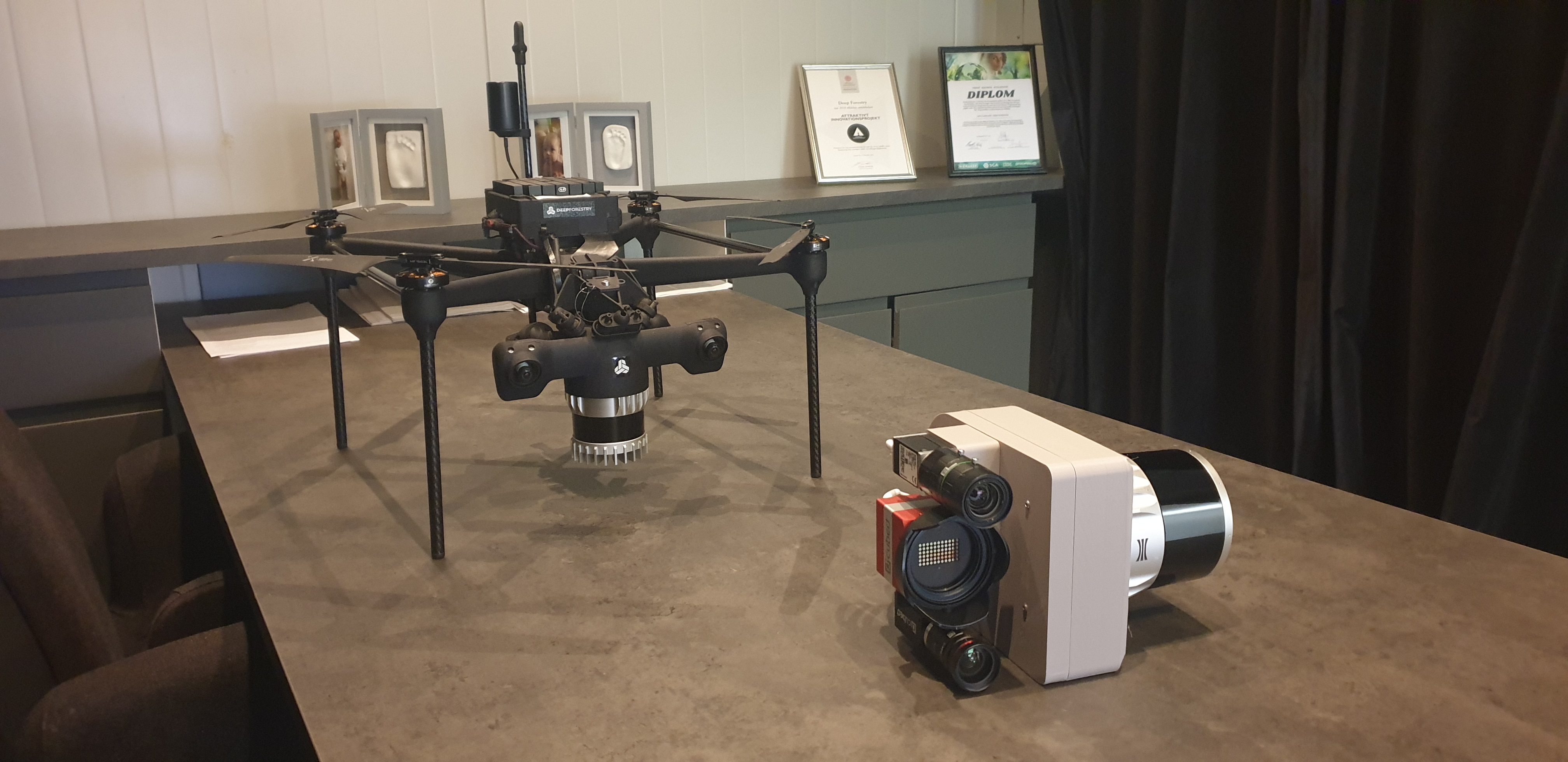
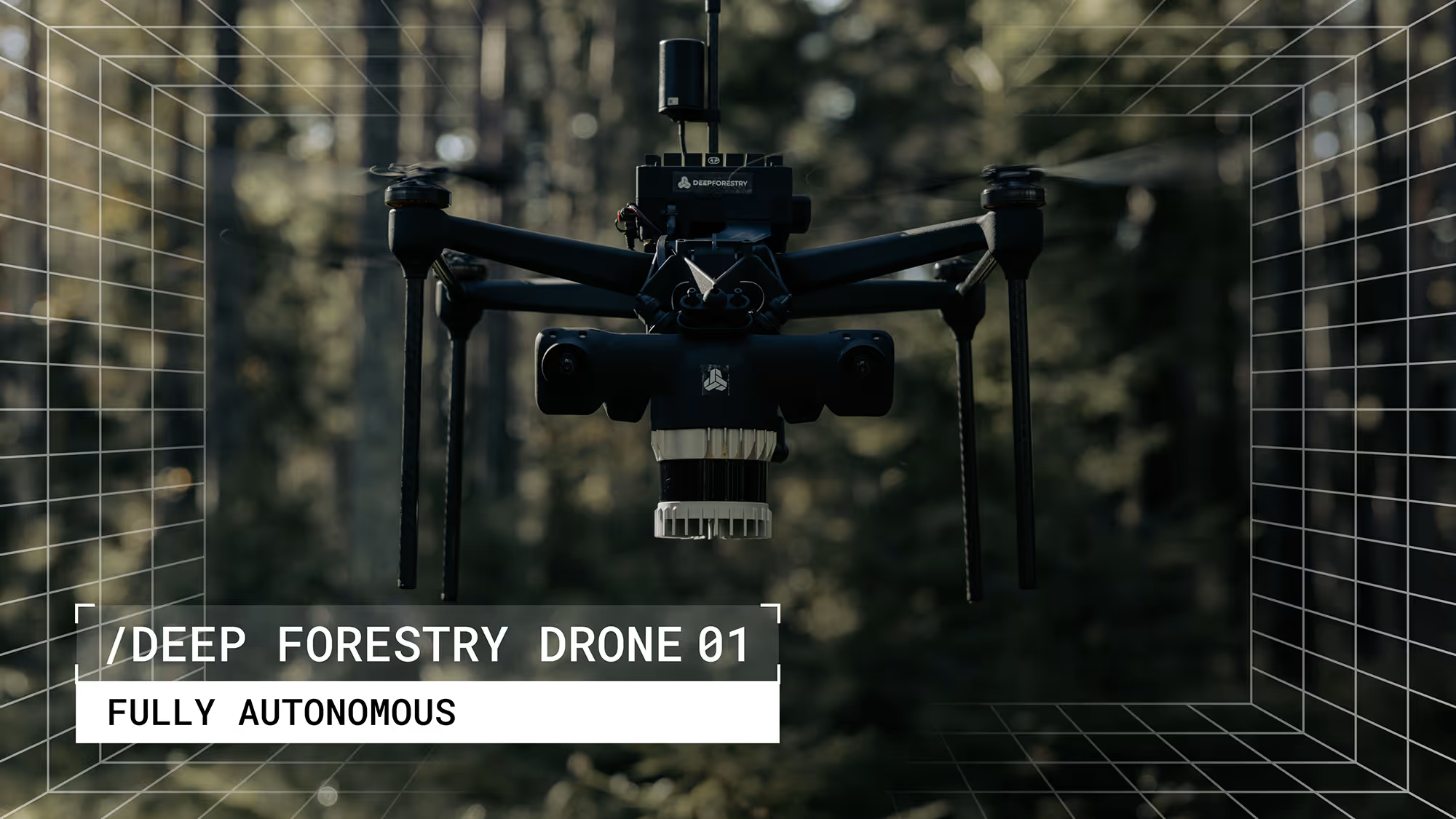
Autonomous Below-Canopy Drones
Self-flying drones designed to navigate between trees beneath the forest canopy, generating detailed 3D replicas of entire forests with full-stem tree data.
- Precise stem analysis measuring 500+ trees in 10 minutes
- Covers up to 1 hectare per flight
- One-button launch—anyone can operate it
Above-Canopy 3D Hyperspectral Payload
Operates above the tree canopy, combining hyperspectral and LiDAR data for comprehensive 3D forest overview at scale.
- Surveys over 50,000 trees in 30 minutes
- Covers up to 100 hectares per flight
- Multi-spectrum plant health analysis
End-to-End Cloud AI Pipeline
AI-powered cloud platform for automated analysis using advanced neural networks. Get tree-level metrics, historical trends, and customizable insights.
- Multi-modal AI integrating 2D, 3D, RGB, and hyperspectral data
- Real-time forest visualization and decision-making
- API-ready for ERP, ESG, and management tools

How It Works
From autonomous surveying to actionable insights in three simple steps
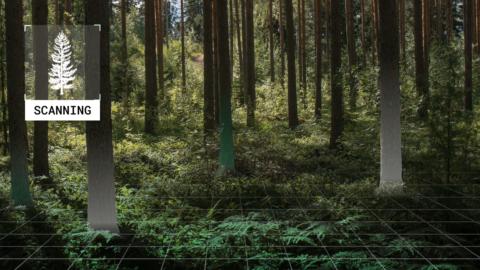
Autonomous Drone Surveying
The drone navigates below the canopy, scanning every tree in the forest and uploading data to the cloud—fully automatic.
Precision AI Processing
Based on the drone data, AI analyzes every tree's height, diameter, volume, species, health and more with millimeter accuracy—zero guesswork.
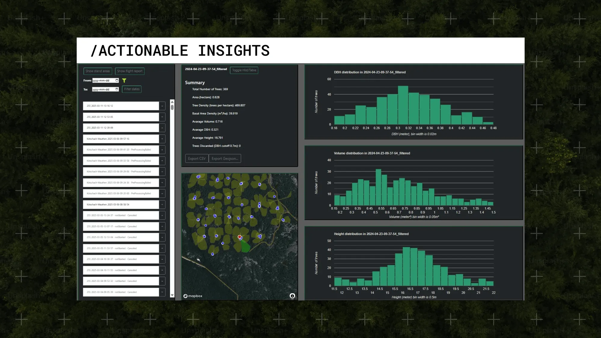
Instant Actionable Insights
Get clear, AI-driven information for forest management, biodiversity, and ESG. No GIS expertise needed.
Target Applications
Forestry Management
- Complete forest inventory
- Growth tracking and planning
- Harvest optimization
- Species identification
ESG & Carbon Markets
- Carbon stock measurement
- ESG compliance reporting
- Carbon market verification
- Sustainability tracking
Biodiversity Monitoring
- Ecosystem health tracking
- Habitat mapping
- Conservation planning
- Environmental impact assessment
Plantation Management
- Palm oil inventory
- Rubber plantation monitoring
- Fruit tree orchards
- Yield prediction
Research & Academia
- Climate research
- Forest ecology studies
- Biomass estimation
- Land use analysis
Government & GLCs
- National forest monitoring
- Land management
- Regulatory compliance
- Policy implementation
Proven Global Performance
Kajima Corporation (Japan)
Below-canopy surveying throughout Japan. Multiple pilot projects across all types of Japanese forests with A/B testing against existing digital and traditional methods.
Result: Outperformed all alternatives by 10-30x. Long-term contract signed.
Australian Government
Radiata pine full-stem accuracy verification. Government-funded industrial pilot project validating precise Mean Absolute Error (MAE) via A/B testing.
Result: Confirmed MAE of less than 5% along entire stem, 1.6cm MAE overall.
Ready to Deploy in Malaysia?
ALJ Global is your authorized DeepForestry partner for Malaysia and ASEAN. Schedule a consultation to discuss deployment for your forestry, plantation, or conservation projects.